Birje (19.09.2015)

Skrevet av HHauser (Helwig Hauser)

| Startsted | Near Øydvenstod (10moh) |
|---|---|
| Sluttsted | Near Øydvenstod (10moh) |
| Turtype | Spasertur |
| Turlengde | 3t 00min |
| Distanse | 12,9km |
| Høydemeter | 632m |
| GPS |
|
| Bestigninger | Storfurehaugen (258moh) | 19.09.2015 |
|---|---|---|
| Åsen (268moh) | 19.09.2015 | |
| Andre besøkte PBE'er | Birgjefletene (182moh) | 19.09.2015 |

Trip Summary
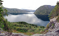
Starting from a place near Øydvenstod, I first followed Osavegen up to the saddle towards Ulvik. There, I turned left, westwards, and ascended the few meters up to Håheim. From there, I followed the marked path -- in southwestern direction -- in order to get up to Åsen. It's not so clear, where the top actually is -- Åsen is well-covered with a forest and there are a number of ups and downs. I found my way to the antenna that is also seen from Ulvik and from there, via a simple path, down to Vattatveit. From there, I first followed the forest road, but when it turned left -- in eastwards directions -- I left it (to the right) and crossed Trånemyrhaugen (basically without any path). I crossed another forest road and continued (without path), this time up Vetlefurehaugen. On the other side, I descended back to the forest road that I had left shortly after Vattatveit and followed it towards southwest, parallel to Osafjorden. At the end of this small peninsula, I got to a point called Birje. I descended as fas as I could until I found myself on top of a vertical drop. There, I enjoyed the overview Osafjorden (where it meets Ulvikafjorden), before I turned around. I got back to the forest road which I had taken before and followed it back, now in northeastern direction. Just because it was so tempting, I quickly went up to Storefurehaugen, before heading back to where I had started. I rounded Åsen along the forest road, descended to Øydvenstod, and returned to the place where I had started. All in all, a simple walk with nice views, mostly over Osafjorden.
Photos
Selected photos are available as Google+ photo album.


Kommentarer